The Philippine Atmospheric, Geophysical and Astronomical Services Administration (PAGASA) gives the latest update about the weather condition as of today October 27, 2020.
According to weather bureau Typhoon Quinta is gradually moving towards the West Philippine Sea but it continues to affect weather conditions in the country with moderate to heavy rains in the areas of Western Visayas, Occidental Mindoro, Palawan – Cuyo, Calamian, Aurora, Isabela Cagayan and Kalayaan Islands while the moderate to occasional heavy rains affecting Northern Mindanao, Zamboanga Peninsula, Caraga, Bangsamoro and the rest of Luzon and Visayas.
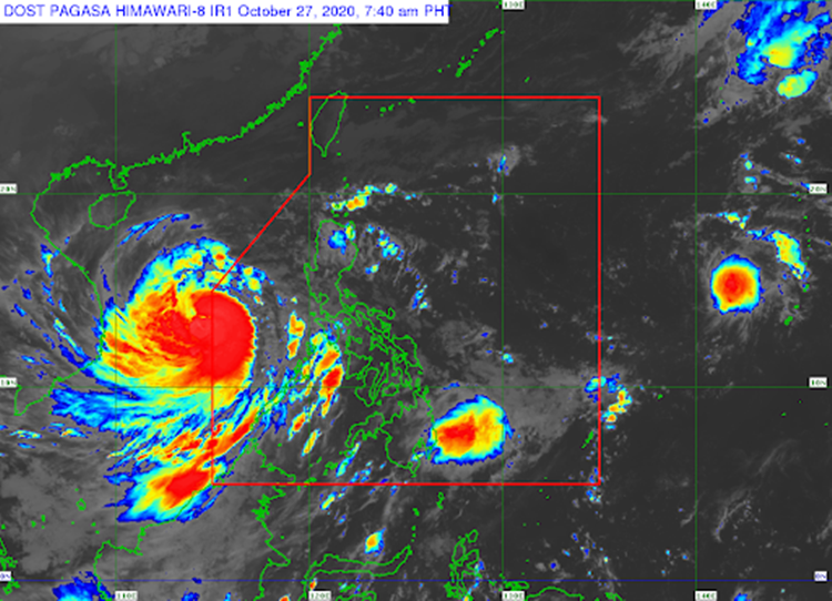
However, in the area of Kalaayan islands is still reportedly experiencing Tropical Cyclone Wind Signal No.1 as Quinta gradually leaving the PAR.
While Quinta is moving out another citing of new Low Pressure Area that is expected to affect Philippine Area of Responsibility(PAR) within this week maybe on Wednesday or Thursday. The LPA may intensify to form tropical depression with the next 38-hours.
Weather advisory left to warn in the coastal areas in the norther and western part of Luzon which is still experiencing from rough to very rough seas as of today while eastern seaboards of Central and Southern Luzon is in moderate to rough sea condition as well as in the seaboard of Palawan and Western Visayas.
Follow us in Facebook and Twitter to keep updated. You can also leave comment here below.


