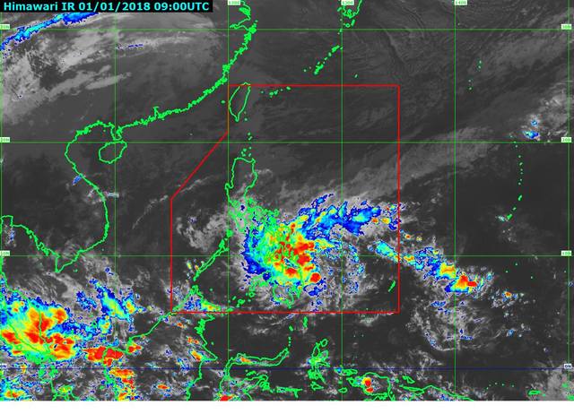
The Tropical Depression “Agaton” is making its landfall in the area of Caraga between late Monday night and early on Tuesday January 2. 2018.
According to PAGASA weather report updates, Agaton was noticed 175 kilometers east northeast of Hinatuan, Surigaw del Sur moving its direction towards west at 19 kilometers per hour.
The local name “Agaton” is the country’s first tropical cyclone for this year 2018 intensified into tropical depression since its landfall in Mindanao areas affecting 17 areas in the countries with maximum sustained wind of 45 (km/h) kilometers per hour and gustiness of up to 60 km/h.
Earlier, the PAGASA raised signal number 1 in the areas of:
- Southern Leyte
- Surigao del Norte including Siargao Island
- Surigao del Sur
- Dinagat Islands
- Agusan del Norte
- Agusan del Sur
- Davao Oriental
- Davao del Norte
- Davao del Sur
- North Cotabato
- Compostela Valley
- Misamis Oriental
- Misamis Occidental
- Lanao del Norte
- Lanao del Sur
- Camiguin
- Bukidnon
https://www.facebook.com/PAGASA.DOST.GOV.PH/videos/1501861476590423/
Agaton will cross similar track of the last deadly tropical cyclone in 2017 “Vinta (Tembin) in the areas of Caraga, Northern Mindanao, Zamboanga Peninsula, and Southern Palawan.
Agaton’s volume of rain may not be the same with Vinta but PAGASAG Weather Division Chief Esperanza Cayanan said during the news briefing not to take it for granted and warned residents of nearby Bicol, Eastern Visayas, Caraga and Davao always on alert for possible flash floods and landslides.
The sea travels are also risky to the areas under signal number 1including the areas of Northern and Southern Luzon and the seaboard of Central Luzon, eastern and western seaboard of Visayas due to the surge of the northern monsoon.


