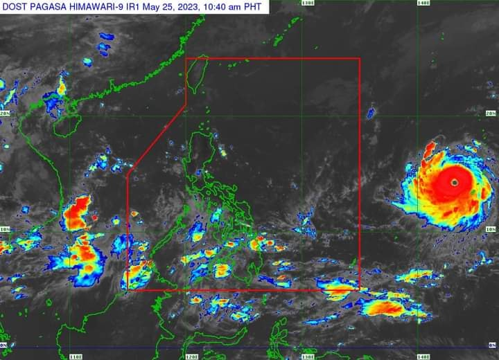
According to the latest bulletin from PAGASA at 11 A.M., Super Typhoon “Mawar” is still moving towards the west while maintaining its current intensity.

The storm has the potential to maintain its super typhoon status even upon entering the Philippine Area of Responsibility.
In breaking news, we have a weather update from one of our sources. Stay tuned for more information. A storm appears to be approaching our area and is expected to enter the Philippine Area of Responsibility by tomorrow evening or Saturday morning.
By tomorrow evening or Saturday morning, the storm may enter PAR and be locally referred to as “Betty.”
In breaking news, the agency has released their latest forecast indicating a potential increase in the Tropical Cyclone Wind Signal in the upcoming days.
The Disaster Risk Reduction and Management Office in Bacolod is taking proactive measures in anticipation of an upcoming typhoon that is expected to hit the Philippine Area of Responsibility on Friday evening, May 26, 2023, or early morning on Saturday. The office is currently focused on clearing the waterways in the area to mitigate potential damage caused by the typhoon.
In a move to prepare for the potential impact of Typhoon Mawar, Mayor Albee Benitez convened a meeting with the disaster risk reduction and management council on Wednesday, May 24. The meeting aimed to discuss the possible effects of the typhoon on the city. In a breaking news update, it has been reported that upon arrival in PAR, Mawar will be referred to as BettyPH.


