According to the state weather bureau, PAGASA, a low-pressure area and shear line will bring rain to most of the country.
The Philippine Atmospheric, Geophysical, and Astronomical Services Administration issued the most recent weather update in the country on Wednesday, January 11, 2023. The weather in the country will be influenced by a low-pressure area and a shear line.
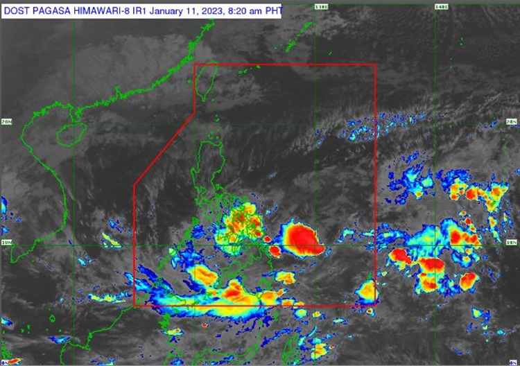
According to PAGASA, a low-pressure area was last seen 295 kilometers east of Hinatuan, Surigao del Sur. Within the next 24 hours, the LPA has a slim chance of developing into a tropical cyclone.
The LPA will affect areas east of Surigao del Sur, while the shear line will affect parts of southern Luzon and Visayas. Over Bicol Region, Visayas, and Mindanao, the LPA will bring cloudy weather with scattered rain showers and thunderstorms.
“Dahil sa pinagsamang epekto ng shear line at low pressure area, inaasahan natin ang patuloy na pag-ulan, pagkidlat at pagkulog, sa may bahagi ng Bicol Region, gayundin sa malaking bahagi ng Visayas at sa bahagi ng Mindanao. Sa mga binanggit nating lugar, patuloy na pinag-iingat ang ating kababayan, lalong-lalo na sa banta ng pagbaha at pagguho ng lupa dahil may ilang araw na rin umuulan sa nabanggit nating lugar,” Patrick Del Mundo, a Pagasa forecaster, stated
Over the Cagayan Valley, Aurora, Quezon, Marinduque, and Oriental Mindoro, the northeast monsoon will bring cloudy skies and rain.
Amihan will also bring partly cloudy to cloudy skies with light rains to Metro Manila and the rest of the Philippines.
The weather service has also warned residents in the affected areas of the possibility of flash floods or landslides due to moderate to heavy rains.
Meanwhile, coastal water conditions will be moderate to rough over Luzon, Visayas, and Mindanao.


Thanks.