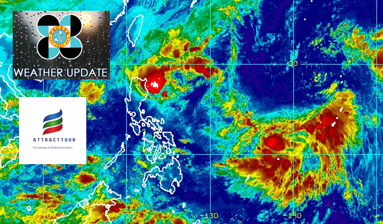
PAGASA said Tuesday that six locations remained under Signal No. 1 as Tropical Depression Maymay maintained its power while moving slowly west-southwestward over the Philippine Sea east of Aurora.
It’s 11 a.m. PAGASA stated in its bulletin that the following are under Signal No. 1, where winds of 39-61 km/h are predicted in at least 36 hours or intermittent rains are likely in at least 36 hours:
Isabela
Quirino
Nueva Vizcaya
Aurora
Nueva Ecija
the far northwestern part of Quezon (General Nakar and Infanta), such as the Pollilo Islands
Maymay is expected to continue moving slowly west southwestward or westward towards Central Luzon, based on the track and intensity projection.
Its core is expected to make landfall in Aurora or the northern part of Quezon on Wednesday afternoon or evening.
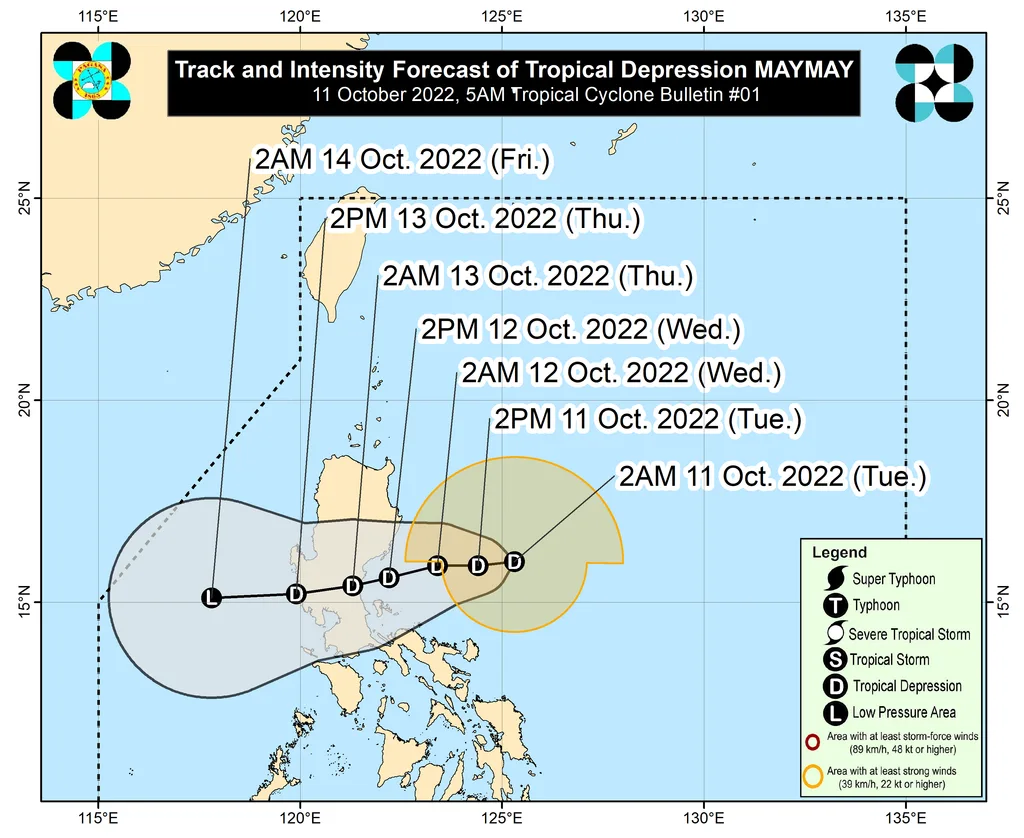
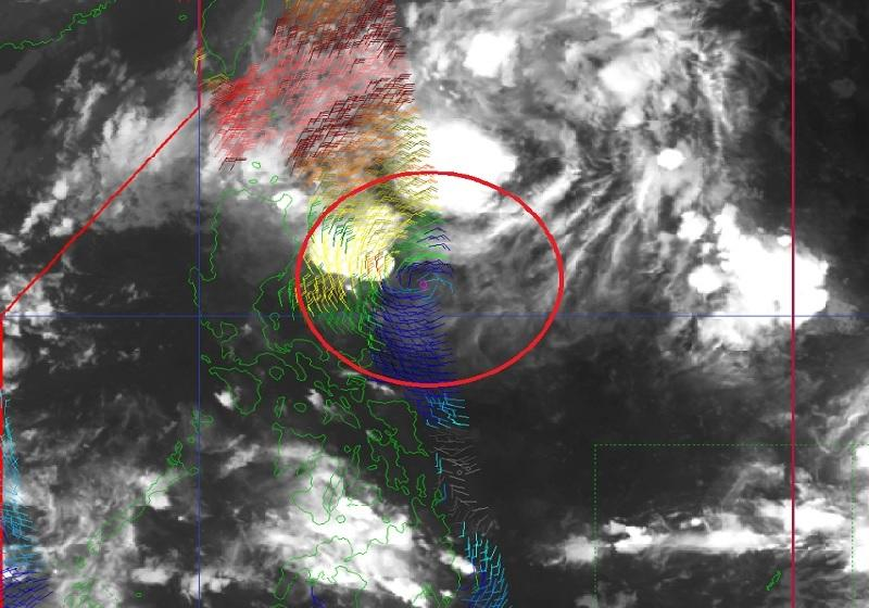
The center of Maymay was assessed to be 285 kilometers east of Casiguran, Aurora (16.1 °N, 124.8 °E), with maximum sustained winds of 45 kilometers per hour in the core and gustiness of up to 55 kilometers per hour.
From Tuesday through Wednesday morning, PAGASA predicts moderate to heavy, at times severe rainfall across Cagayan, Isabela, Batanes, and Apayao.
However, showers ranging from light to moderate to heavy are projected for Aurora, Abra, Kalinga, Mountain Province, and Ilocos Norte.
PAGASA also stated that over the next 24 hours, occasional strong winds reaching gale-force strength may be encountered (particularly in the coastal and mountainous regions) over Batanes, Cagayan, as well as the Babuyan Islands, Apayao, and Ilocos Norte due to the increased northeasterly surface windflow and its integration with the tropical depression circulation.
Because of the impact of Maymay and the surge of northeasterly surface windflow, PAGASA has issued a marine gale warning for the seaboards of Northern Luzon and the eastern seaboards of Central and Southern Luzon.
The increase of northeasterly surface windflow may also produce medium to rough seas (1.5 to 3.5 m) across the western coast of Central Luzon in the next 24 hours, according to the forecast.
The circumstances may therefore be hazardous for individuals operating small seacraft, and mariners are recommended to use caution while heading out to sea and, if feasible, avoid travelling in the stated conditions.
Maymay has already resulted in class cancellations in Cagayan.
In addition, the Manila International Airport Authority issued an early list of cancelled flights due to inclement weather.
However, a tropical depression outside the Philippine Area of Responsibility (PAR) is expected to slow down as it moves roughly north northeastward over the next 12 hours before turning northward to northwestward and picking up pace.
According to the prediction, the tropical depression could make landfall in PAR on Thursday morning or afternoon. On the same day, it might strengthen over the Philippine Sea and become a tropical storm.
PAGASA predicts that Tropical Cyclone Wind Signals will be hoisted over Batanes and numerous provinces in Northern Luzon, with the strongest probable wind signal being Signal No. 2.
It went on to say that the tropical cyclone’s passage across Extreme Northern Luzon might deliver heavy rain to the area starting Saturday.
Beginning late Friday or Saturday, the tropical cyclone may also bring severe to very rough seas to Luzon’s northern and eastern seaboards.


