State weather bureau Philippine Atmospheric, Geophysical and Astronomical Services Administration has announced in its 5:00 a.m. updates on Tuesday, October 18, 2016 the “Bagyong Lawin” with an international name ‘Haima’ has strengthen further while moving to the Philippine Sea.
Before it will be expected to landfall in Cagayan Area by early morning on Thursday, Oct. 20, Typhoon Lawin will intensify further. Then it will cross to the direction of Apayao and Ilocos Norte. By Friday morning, Oct. 21, ‘Lawin is expected to go out of the Philippine Area of Responsibility (PAR).
As of 4:00 a.m., the center of ‘Bagyong Lawin’ was located at 1,075 km East of Daet, Camarines Norte (14.6°N, 132.9°E). it has a maximum sustained winds of up to 185 kph at the center and gustiness of up to 230 kph.
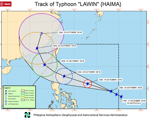
‘Lawin’ is expected to move West Northwest at 24 kph.
Tropical cyclone warning signal (TCWS) No. 1 ; 30-60 kph expected in 36 hours was raised at the areas of Cagayan, Isabela, Catanduanes and Northern Aurora.
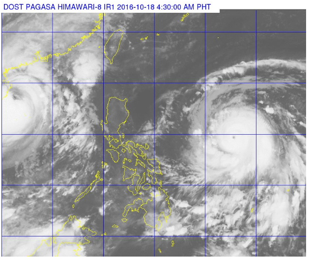
The estimated rainfall amount of Typhoon Lawin is from moderate to heavy within the 700 km diameter.


