Top Trending topic online! The Department of the Interior and Local Government (DILG) Central Office Disaster Information Coordinating Center (CODIX) released a list of areas that could be hit by tropical depression “Onyok”, on Thursday, December 17, 2015.
Forecast Positions:
- 24 hour (Tomorrow evening): Vicinity of Hinatuan, Surigao del Sur.
- 48 hour (Saturday evening): 265 km West Southwest of Dipolog City or 170 km Northwest of Zamboanga City (as a Low Pressure Area).
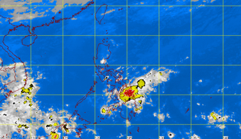
At 10:00 Thursday, the center of ‘Bagyong Onyok’ was estimated based on allavailabledata at 415 km East of Hinatuan, Surigao del Sur (8.4°N, 130.1°E). It has maximum winds of 55 kph near the center and forecast to move West at 17 kph.
It raised an alert over the following areas, which are within the 300-kilometer diameter of the forecast track of the storm:
- Agusan del Norte
- Agusan del Sur
- Basilan
- Bukidnon
- Camiguin
- Compostela Valley
- Davao del Norte
- Davao del Sur
- Davao Oriental
- Lanao del Norte
- Lanao del Sur
- Maguindanao
- Misamis Occidental
- Misamis Oriental
- Negros Oriental
- North Cotabato
- Shariff Kabunsuan
- Siquijor
- Sultan Kudarat
- Surigao del Norte
- Surigao del Sur
- Zamboanga del Norte
- Zamboanga del Sur
- Zamboanga Sibugay
Public storm signal number 1 was hoisted over the following areas:
- Surigao del Sur
- Siargao Island
- Surigao del Norte
- Dinagat Province
- Misamis Oriental
- Camiguin
- Agusan del Norte
- Agusan del Sur
- Davao Oriental
- Davao del Norte
- Compostela Valley
- Bukidnon
- Lanao del Norte
- Lanao del Sur
- Misamis Occidental
- Davao del Sur
- North Cotabato
PAGASA said residents in low-lying and mountainous areas of the provinces with public storm warning signals are alerted against possible flashfloods and landslides.
For more updates, please follow us on Twitter and by linking us on Facebook.


