As of December 11, 2014, at around 4:00a.m., the Philippine Atmospheric, Geophysical and Astronomical Services Administration (PAGASA) has released its weather bulletin of the day spotting “Low Pressure Area” (LPA) at about 1500 km away from East Southeast of Mindanao.
 According to PAGASA if the spotted LPA will develops into a tropical cyclone it will be named “Bagyong Seniang” upon reaching the Philippine Area of Responsibility (PAR).
In an interview with weather forecaster Glaiza Escullar, published on Interaksyon.com, she said that there is nothing to worry at this time because the spotted cloud cluster is still very far from the Philippine Area of Responsibility.
The prediction of “Bagyong Seniang” caught the attention of the netizens since last week following after the report published earlier on this website, quoting the column of Freeman Opinion Leo Lastimosa of Philstar.com published last November 29, 2014. According to the report, the second typhoon after “Bagyong Ruby” (Hagupit) will be expected more powerful and devastating.
PAGASA weather forecaster Jori Loiz, clarifies that although PAGASA has spotted weather disturbance in the Pacific Ocean but it is very far from the Philippine Area of Responsibility and there is high possibility that the said weather disturbance will dissipate.
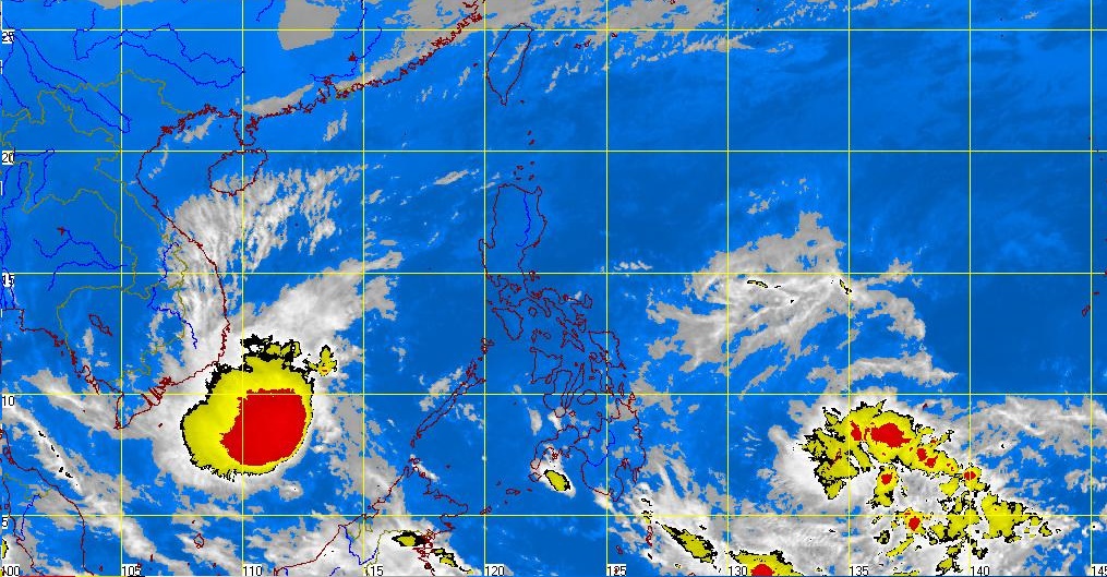
This report was also confirmed by Japan’s MTSAT-2 satellite image concerning the spotted LPA in the Pacific Ocean that the said weather disturbance is very far and slow and that possibly will not develop into a tropical cyclone.
The US Navy’s Joint Typhoon Warning Center (JTWC), also described about the potential development of the LPA into the tropical cyclone within the next 24-hour, according to them the possibility is very low.
Similar report also appeared on NASA’s Hurricane Facebook Page, confirming the Tropical Low Pressure Area “System 96W,” traced about 6.0 north latitude and 141.9 East latitude which is 310 miles southeast of Yap Island and according to them they will continue keep on tracking its movement.
However, PAGASA Visayas Director Oscar Tabada assured that despite of the cloud formation outside of the Philippine Area of Responsibility, the country will continue enjoying good weather condition especially in the Visayas provinces.
On the other hand, PAGASA predicted that there will be possibly at least two typhoons to enter the country before the end of this year 2014, says Pagasa officer-in-charge Landrico Dalida Jr.


