The Philippine Atmospheric, Geophysical and Astronomical Services Administration (PAGASA) announces updates of Bagyong ‘Nimfa’. The Tropical Storm Nimfa has maintains its strength while moving slowly over the Philippine Sea.
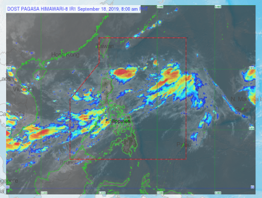
According to PAGASA, “Between tonight and tomorrow (18 September) evening, frequent light to moderate rains with occasional heavy rain showers during thunderstorms will be experienced over Central Luzon, Batangas, Cavite, Occidental Mindoro, and northern portions of Palawan including Calamian and Cuyo Islands.”
Bagyong ‘NIMFA’ has a maximum sustained winds of 55 kph near the center and gustiness of up to 70 kph. At 10:00 PM today, the Low Pressure Area was estimated in the vicinity of Mayantoc, Tarlac (15.5°N, 120.2°E). This weather disturbance may cross over Central Luzon and may eventually dissipate within the circulation of “NIMFA,” PAGASA report.
The location of Bagyong NIMFA At 10:00 PM today, the center of Tropical Depression “NIMFA” was estimated based on all available data at 685 km East of Basco, Batanes (21.0 °N, 128.5 °E).
Share your thoughts and comment in discussion box below.


