
Tropical storm Paeng, which could make landfall twice and prompt wind signal No. 3 in some areas, will bring heavy rains and strong winds to Metro Manila and large swaths of the country this weekend, according to PAGASA.
Paeng is expected to hit Catanduanes on Saturday morning before moving to the northern portion of Camarines Sur and eastern Camarines Norte, according to the state weather bureau’s 11 a.m. forecast. bulletin.
According to PAGASA, Paeng could make a second landfall over the east coast of Quezon, including the Polillo Islands or Aurora, on Sunday morning.
PAGASA said it might raise Tropical Cyclone Wind Signal No. 3 based on the latest track and intensity forecast.

Winds of 89 to 117 kph could cause minor roof damage on well-built houses, knock out power, disrupt telecommunications and water supply, and break small trees, according to PAGASA.
SIGNAL 1 AND 2 ARE ALREADY ON
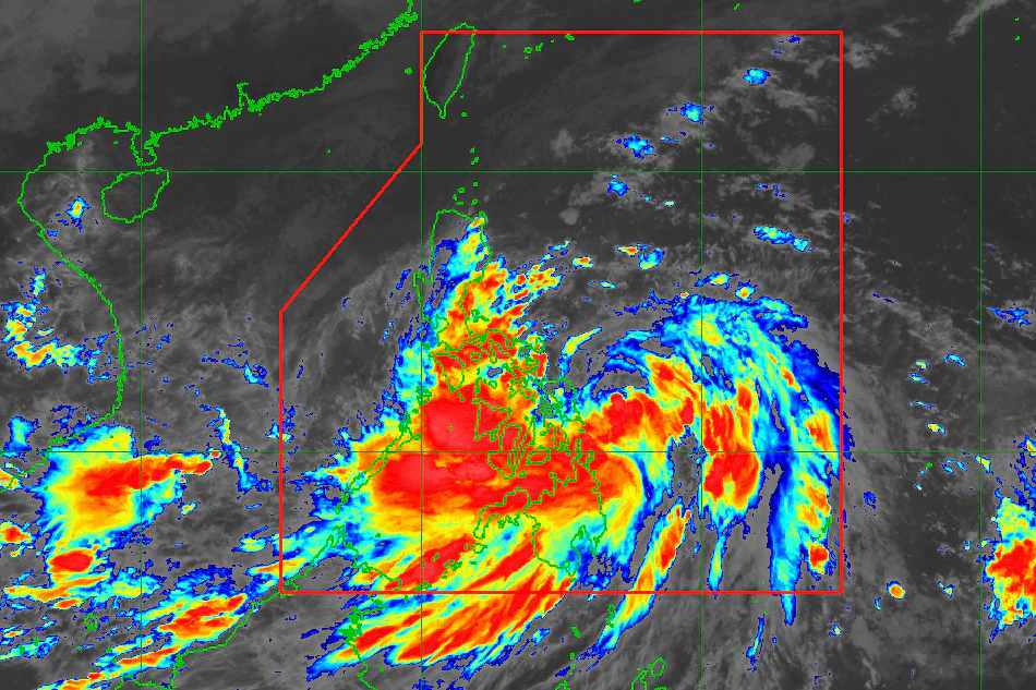
Paeng was 220 kilometers east-northeast of Borongan City, Eastern Samar, at 10 a.m., maintaining its strength with maximum sustained winds of 75 kilometers per hour near the center and gusts up to 90 kilometers per hour.
Paeng accelerated, moving west northwestward at 25 kph, according to PAGASA.
The weather service issued Signal No. 2 in the following areas, where winds of 62 to 88 kph are expected within the next 24 hours.

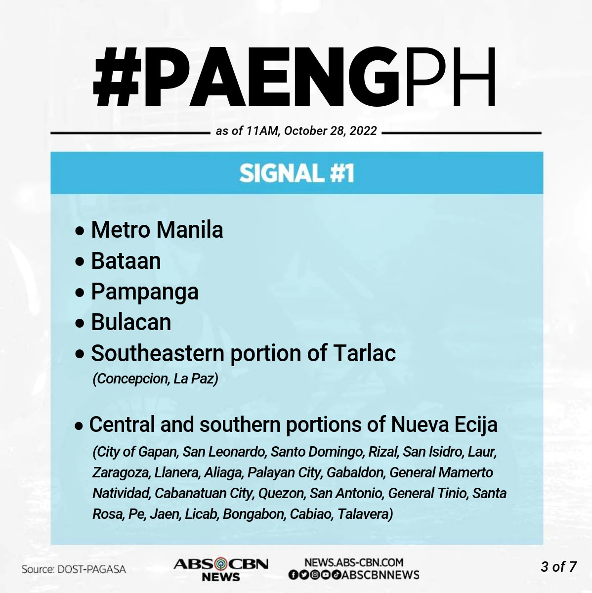
PAGASA issued Signal No. 1 in Metro Manila and the following areas, where 39 to 61 kph winds are expected in 36 hours.
HEAVY RAINS
According to PAGASA, Paeng is expected to intensify while moving over the Philippine Sea and could become a severe tropical storm within 24 hours.
However, due to the possibility of a second landfall in the Bicol region, Paeng “is less likely”‘ to reach typhoon status, according to the weather bureau.
Paeng will bring heavy rains to parts of the country, including Metro Manila, which has a population of about 13 million people.
“Even in Metro Manila, inaabisuhan na po natin kung maaari na lang muna sa ating mga tahanan dahil mas ligtas po doon,” PAGASA weather forecaster Veronica Torres told ABS-TeleRadyo. CBN’s
(Even in Metro Manila, we advise residents to stay at home because it is safer.)
PAGASA warned of heavy to intense rains, at times torrential, over the Bicol region and Eastern Visayas from Friday to early Saturday morning.
Quezon, Mimaropa, Caraga, Zamboanga Peninsula, Bangsamoro, Northern Mindanao, and the rest of Visayas may experience moderate to heavy rains, while Metro Manila, Cagayan Valley, Aurora, and the rest of Calabarzon and Mindanao may experience light to moderate rains.
PAGASA warned that heavy to intense rains, at times torrential, could hit Calabarzon, Bicol region, Aurora, Isabela, Nueva Vizcaya, and Quirino from Saturday morning to Sunday.
Rains will be moderate to heavy, and at times intense, in Metro Manila, Cagayan de Oro, the Cordilleras, Western Visayas, Marinduque, Romblon, Mindoro Provinces, and the rest of Central Luzon. Over the Zamboanga Peninsula and the rest of Luzon and Visayas, light to moderate rains with periods of heavy rain are possible.
“Flooding and rain-induced landslides are expected under these conditions,” PAGASA said.


