Tropical storm Inday might become a strong tropical storm during the next 24 hours, according to an advisory issued by the state meteorological service PAGASA around midday Thursday.

Inday may increase further as it tracks the “favorable environment” of the Philippine Sea, according to the report.
“The possibility of a rapid intensification within the forecast period is not ruled out,”it stated.
However, according to the most recent forecasts, Inday is unlikely to have a direct impact on the weather in the archipelago throughout the predicted period.
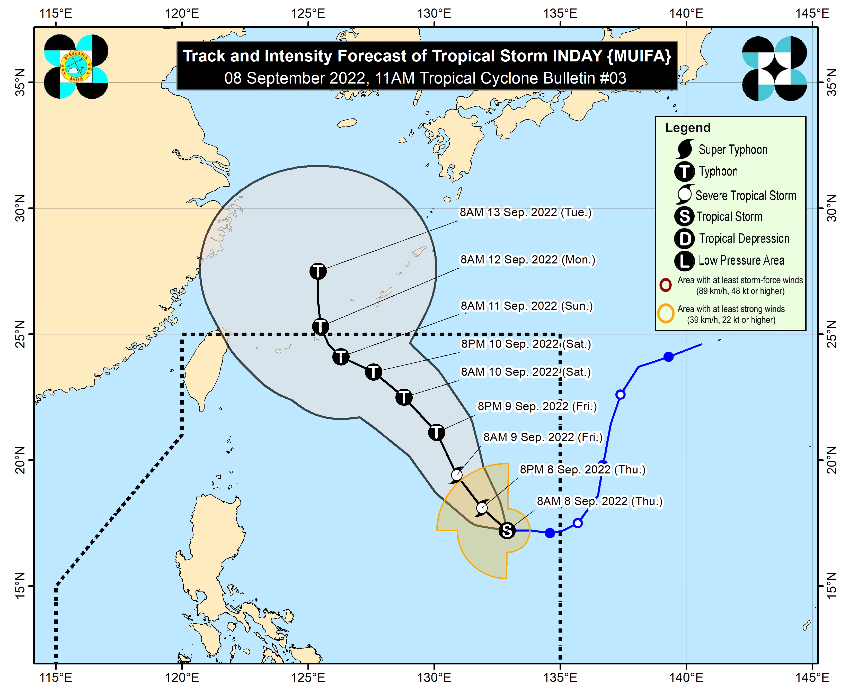
As of 11 a.m., tropical storm Inday has been identified 1,130 kilometers east of Central Luzon.
Inday is moving westward at 20 kph, with maximum sustained winds of 75 kph in the center and gusts of up to 90 kph.
However, no wind alert has been issued in any region of the nation thus far.
According to PAGASA, Inday may leave the Philippine area of responsibility on Sunday or Monday.
Meanwhile, the Intertropical Convergence Zone, or belt of clouds and isolated thunderstorms, is mostly impacting the country’s weather.
According to the meteorological service’s 24-hour alert issued at 4 a.m., cloudy skies with scattered rain showers and thunderstorms are possible across Western Visayas, the Zamboanga Peninsula, Northern Mindanao, and BARMM. Thursday
Meanwhile, Metro Manila and the rest of the nation might anticipate sporadic rain showers or thunderstorms in the coming hours.


