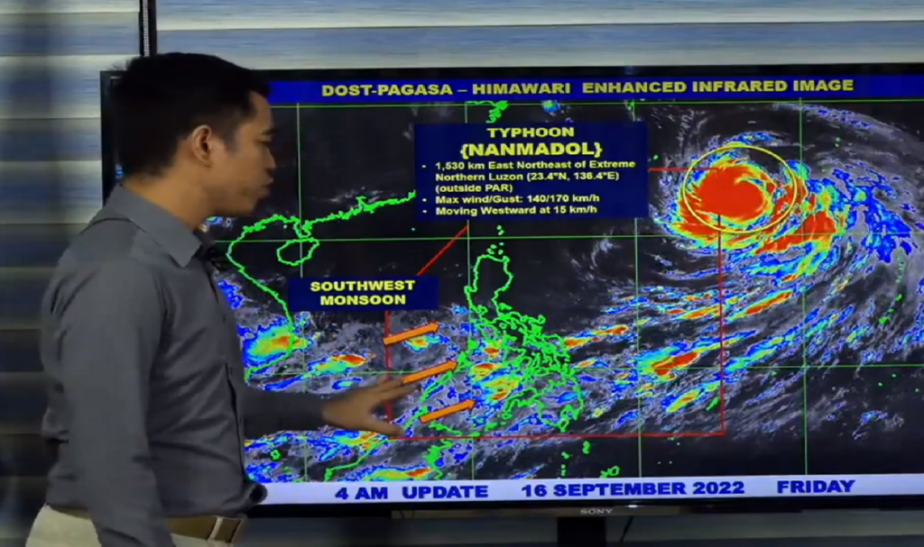
Typhoon Nanmadol remains outside the Philippine area of responsibility (PAR), but rain is expected in parts of the country on Friday due to an enhanced southwest monsoon, or “habagat,” according to the Philippine Atmospheric, Geophysical, and Astronomical Services Administration (Pagasa).
“Walang direct effect itong kabuuan, bagamat malawak itong si Typhoon Nanmadol sa malaking bahagi ng ating bansa, and yung habagat o yung southwest monsoon ay unti-unti pa rin pong pinalalakas nitong si Bagyong Nanmadol dito po sa Southern Luzon, Visayas, at western section of Mindanao ”
Benison Estreja, a Pagasa weather specialist, stated in the bureau’s public weather forecast.
According to Pagasa, the southwest monsoon will bring partly cloudy skies with isolated rain showers or localized thunderstorms to Metro Manila and the rest of the country.
Typhoon Nanmadol was tracked early Friday morning, 1,530 kilometers east-northeast of extreme Northern Luzon, with maximum sustained winds of 140 kilometers per hour (kph) near the center and gustiness of up to 170 kilometers per hour (kph).
The typhoon is expected to make landfall on the northeastern edge of PAR on Friday.
Pagasa warned that flash floods and landslides are possible in rain-stricken areas.
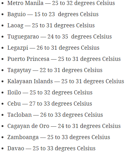
On Friday, the following temperatures are expected in major cities: