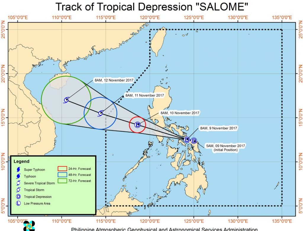
PAGASA release statement that Tropical Depression Salome has slightly intensified as it crosses Ticao pass. The estimated rainfall amount is from moderate to heavy within the 250km diameter of the Tropical Depression.
Bagyong Salome is expected to traverse Sibuyan Sea this afternoon.
According to PAGASA, “Residents of areas under TCWS #1 as well as the eastern section of Central Luzon are advised to be alerted against possible flashfloods and landslides. Sea travel is risky over areas under TCWS #1 due to moderate to rough seas.”

The Bagyong Salome is expected to exit the Philippine Area of Responsibility by Saturday morning.
Location of the Tropical Depression “Salome” was estimated based on all available data at 50 km South Southwest of Juban, Sorsogon (12.6 °N, 123.8 °E).
https://www.facebook.com/PAGASA.DOST.GOV.PH/videos/1451168301659741/
PAGASA announces Tropical Cyclone Warning Signal
“TCWS #1 (30-60kph expected in 36 hrs) Metro Manila, Rizal, Bataan, Camarines Norte, Camarines Sur, Catanduanes, Albay, Sorsogon, Masbate including Ticao and Burias Islands, Romblon, Marinduque, Quezon, Laguna, Cavite, Batangas, Oriental Mindoro, Occidental Mindoro, Northern Samar, Eastern Samar, Samar and Leyte including Biliran.”
Share your thoughts and comment in discussion box below!


