“Lumakas, lumawak at bumilis ang ating bagyo kaya talagang delikado na itong bagyo,”
According to PAGASA meteorologist Samuel Duran in the press briefing Wednesday morning at 5 a.m.
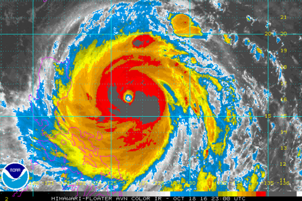
PAGASA- The weather agency said and known that the typhoon will bring intense rain and storm surges as it is moving from one side of Northern Luzon. It has already been declared by the U.S. Naval Observatory’s Joint Typhoon Warning Center (JTWC) that Lawin is now considered as a super typhoon, stated on Tuesday. However, PAGASA has not yet raise but will soon in accordance to differences in the measurements it gives.
As of Octorber 19, 2016, Typhoon Lawin has a continuing 205 kilometers per hour (kph) near the center and gusts of up to 240 kph, according to Duran. The diameter of Typhoon Lawin also get up from 650 kilometers on Tuesday night to 700 kilometers early Wednesday.
The given satellite image shows the moderate to heavy and intense rain that is in Lawin’s diameter.
WATCH BELOW!


