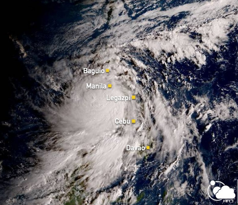
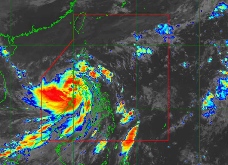
PAGASA LATEST Update “Typhoon Quinta” on October 26, 2020. Typhoon “Quinta” Maintains its strenght and is now over the Mindoro Strait. “QUINTA” will continue to move westward until this afternoon, then will then turn west-northwestward towards the western boundary of the Philippine Area of Responsibility (PAR).
PAGASA stated that Typhoon Quinta is forecast to exit the PAR tomorrow morning. The clouds associated with Typhoon #QuintaPH (#Molave) and the Tail End of a Frontal System covered the Philippine Archipelago this morning (7:00 AM PhST). Stay safe!
Related article: Virtual Class Suspension in different areas in the Philippines

According to PAGASA, it is particularly stormy right now in Metro Manila, CALABARZON, Marinduque, Romblon, Mindoro Provinces, and Calamian Islands due to the typhoon.
At 10:00 AM today, a Low Pressure Area (LPA) was estimated based on all available data at 1,920 km East of Southern Luzon (13.9 °N, 142.0 °E). This LPA may enter the PAR on Wednesday or Thursday morning but is less likely to develop into tropical depression in the next 48 hours.
PAGASA statement, “the center of “QUINTA” was estimated based on all available data at 125 km North of Coron, Palawan or 120 km West Southwest of Calapan City, Oriental Mindoro (13.1 °N, 120.1 °E ).”
Share your thoughts and comment in the discussion box below.


