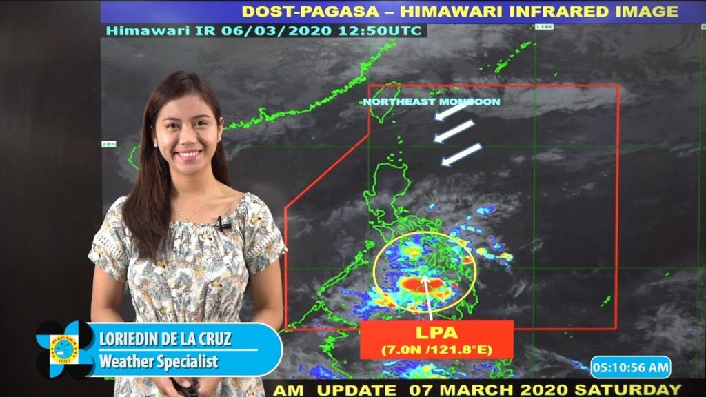
PAG ASA weather forecast for today a Low Pressure area is sighted near Visayas region that bring heavy rains and thunderstroms specifically in the Visayas regions.
Here is the list of heavily affected areas as per PAS AGA UPDATE:
VISAYAS REGION, CARAGA AND ZAMBOANGA PENINSULA this areas will be hardly affected by heavy rains expect for possible flash floods and lanslides.
Bicol Region, Quezon, Marinduque, and Romblon affected by Tail end cold front but still be prepared for flash floods and landslides due to heavy rains.
The mentioned below cities and provinces is affected by Northeast Monsoon or Hanging Amihan with a remarks of No Significant impact but maybe small rainshowers but no treat or landslides and flash floods.
| Batanes and Babuyan Group of Islands | Cloudy skies with light rains | Northeast Monsoon | No significant impact |
| Metro Manila and the rest of Luzon | Partly cloudy to cloudy skies with isolated light rains | Northeast Monsoon | No significant impact |
| The rest of the country |
To know more on the daily weather forecast please tuned in to our website to bring you the hottest weather news in the country or you can click this link PAG ASA DOST.
The above mentioned cities is recommended to bring rain protection apparels and avoid in flooded area due to the danger of liptospiroses.


