
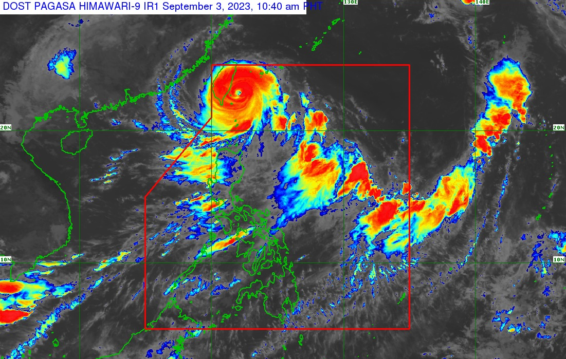
Typhoon HannaPH continues to intensify as it decelerates westward near the coast of southern Taiwan.
Location of Center (10:00 AM): The center of the eye of Typhoon #HannaPH was estimated based on all available data at 220 km north-northeast of Itbayat, Batanes (22.7°N, 122.3°E)
Intensity: Maximum sustained winds of 155 km/h near the center, gustiness of up to 190 km/h, and central pressure of 950 hPa
Present Movement: Westward at 10 km/h
Extent of Tropical Cyclone Winds
Strong to typhoon-force winds extend outwards up to 560 km from the center
The wind signals warn the public of the general wind threat over an area due to the tropical cyclone. Local winds may be slightly stronger/enhanced in coastal and upland/mountainous areas exposed to winds. Winds are less strong in areas sheltered from the prevailing wind direction.
Forecast accumulated rainfall for today
• 50-100 mm: Batanes and the northern portion of Babuyan Islands
Forecast rainfall are generally higher in elevated or mountainous areas. Under these conditions, flooding and rain-induced landslides are possible especially in areas that are highly or very highly susceptible to these hazards as identified in hazard maps and in localities that experienced considerable amounts of rainfall for the past several days.


