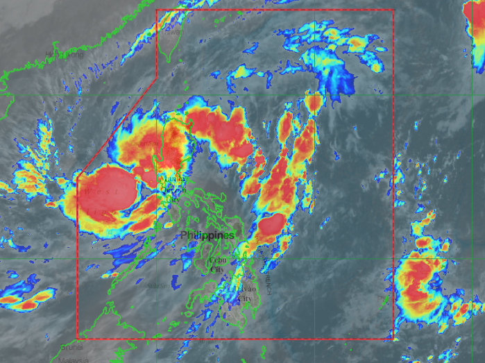
PAGASA released the latest updates of weather in the Philippines as of October 20, 2020. At 9:00 PM today, the center of Tropical Storm “PEPITO” made landfall in the vicinity of San Ildefonso Peninsula in Casiguran, Aurora.
According to PAGASA, “PEPITO” is forecast to move generally westward over the Luzon landmass and emerge over the West Philippine Sea tomorrow morning. This tropical cyclone may exit the Philippine Area of Responsibility (PAR) on Thursday morning or afternoon.
PAGASA added, “PEPITO” will likely maintain its strength while crossing the landmass. However, a slight weakening in its intensity remains a possibility. After crossing Luzon, this tropical cyclone is forecast to further intensity and will likely reach severe tropical storm category on Thursday.”
PEPITO” will bring moderate to heavy rains over Central Luzon, Cordillera Administrative Region, northern Quezon (including Polillo Islands), Nueva Vizcaya, Quirino, Isabela, mainland Cagayan, La Union, and Pangasinan. Light to moderate with at times heavy rains will be experienced over Metro Manila and the rest of Luzon, Western Visayas, Zamboanga Peninsula, and Bangsamoro.
Location of eye/center At 10:00 PM today, the center of “PEPITO” was estimated based on all available data including Baler and Benguet Doppler Radars in the vicinity of Dinalungan, Aurora (16.2°N, 121.8°E). Strength: • Maximum sustained winds of 75 km/h near the center and gustiness of up to 125 km/h.Movement: • Moving Westward at 20 km/h. (Source PAGASA DOST)
Share your thoughts and comment in the discussion box below.