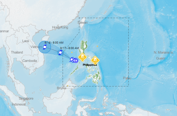
“LEON” will continue tracking west-northwestward throughout the forecast period. It is forecast to exit the Philippine Area of Responsibility (PAR) tomorrow morning.
At 10:00 AM today, the center of Tropical Storm “LEON” was estimated based on all available data at 330 km West Northwest of Coron, Palawan (13.1 °N, 117.4 °E ).
Moving West Northwestward at 15 km/h and Maximum sustained winds of 65 km/h near the center and gustiness of up to 80 km/h.
Forecast Position
- 24 Hour(Tomorrow morning): 455 km North of Kalayaan, Palawan (OUTSIDE PAR)(15.1 °N, 114.3 °E)
- 48 Hour(Friday morning):805 km Northwest of Kalayaan, Palawan (OUTSIDE PAR)( 16.7 °N, 109.5 °E)
PAGASA stated: “The public and the disaster risk reduction and management council concerned are advised to take appropriate actions and watch for the next update to be incorporated in the 4 PM Public Weather Forecast and in the next Severe Weather Bulletin to be issued at 11 PM today.”
Share your thoughts and comment in the discussion box below.