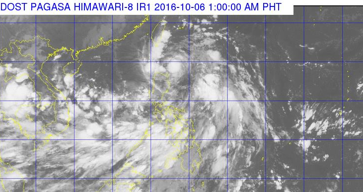
“PAGASA” Philippine Atmospheric, Geophysical and Astronomical Services Administration announce that the Low Pressure Area (LPA) east of Luzon has turn into a tropical depression and named ‘Julian’. As of October 6, 2016 around 1:00 a.m., Light to moderate rains affecting over Cebu (Cordova, Lapu-Lapu City, Mandaue City, portion of Cebu City).
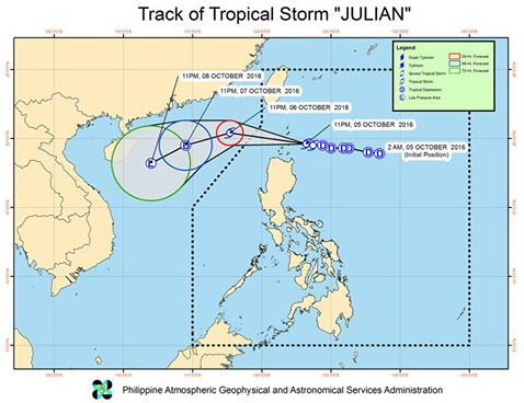
Tropical Storm Julian has maintained its strength as it continues to move westward. At 1:00 AM today, the center of TS JulianPH was estimated at 140 km Southeast of Basco, Batanes (19.6°N, 122.9°E).
According to the PAGASA experts, Bagyong Julian will leave the Philippine Area of Responsibility (PAR) on Friday, October 7, 2016.
Latest updates, Thunderstorm affecting portions of Basilan and Zamboanga Peninsula. All are advised to take precautionary measures against heavy rains, strong winds, lightning and possible flash floods and landslides.
View the satellite below:

Updating—–
For more updates, please follow us on Twitter and by linking us Facebook.


