According to the statement released by the country’s weather bureau, the Philippine Atmospheric, Geophysical and Astronomical Services Administration (PAGASA), Bagyong Ineng (Typhoon Goni) is expected to enter the Philippine Area of Responsibility (PAR) on Tuesday, August 18, 2015.
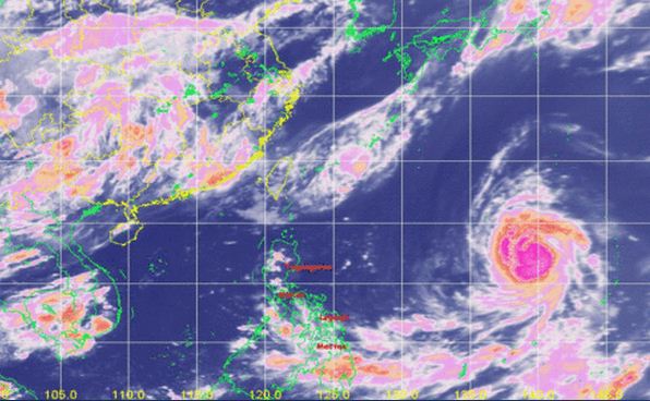
Bagyong Ineng (international name Goni) is moving at the speed of 20 kph and west northwest track. It is expected to cross PAR on Tuesday afternoon.

PAGASA released a statement that the eye of Typhoon Goni was located at 1,945 km East of Luzon with maximum sustained winds of 170 kph near the center and gustiness of up to 205 kph. It is forecast to move West Northwest at 20 kph.
However, the typhoon Goni calculated that it would be cloudy skies with light to moderate rains and isolated thunderstorms will be experienced over Visayas and the region of Northern Mindanao. Partly cloudy to cloudy skies with isolated thunderstorms will prevail over Metro Manila and the rest of the country.
The Southwest to West will prevail over the entire archipelago with slight to moderate seas can be experience a light to moderate winds blowing.
For more updates, please follow us on Twitter and by linking us on Facebook.


