PAGASA (Philippine Atmospheric, Geophysical and Astronomical Services Administration officially confirmed to the media that the Low Pressure Area (LPA) near Catanduanes has developed into a tropical depression and was locally named Bagyong “Egay”. It was last observed 520 kilometers east of Virac, Catanduanes.
It also packed with maximum winds of 45 kilometers per hour near the center, and was moving north northwest at 5 kph. “The tropical depression would pull the southwest monsoon (Habagat) and dump moderate to heavy rain within its 300-km diameter, according to PAGASA.
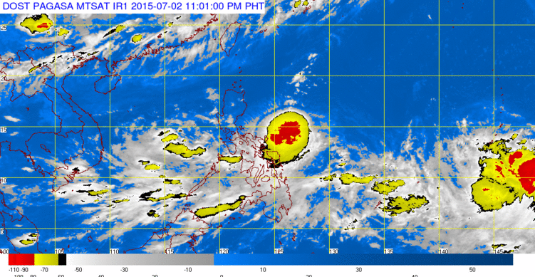
PAGASA is also tracking a severe tropical storm and a low pressure area outside the Philippine Area of Responsibility. Tropical Storm Chan-hom (international name) was last located 3,090 kilometers east of Visayas, while the LPA was 2,275 kilometers east of Mindanao.
PAGASA stated info, estimated rainfall amount is from moderate to heavy within the 300 km diameter of the tropical depression.
Fisher folk are advised not to venture out over the eastern seaboard of Bicol Region and Eastern Visayas.
The public and the disaster risk reduction and management council concerned are advised to take appropriate actions and watch for the next bulletin to be issued at 11 PM today.
Location of Center: (as of 10:00 a.m.) 1,520 km East of Virac, Catanduanes
Coordinates: 13.8°N, 129.1°E
Strength: Maximum winds of 45 kph near the center.
Movement: Forecast to move North Northwest at 5 kph.
Forecast Positions/Outlook:
24 hour (Tomorrow morning): 485 km East of Virac, Catanduanes
48 hour (Saturday morning): 650 km East of Casiguran, Aurora
72 hour (Sunday morning): 640 km East of Tuguegarao City
96 hour (Monday morning): 570 km East of Tuguegarao City
120 hour (Tuesday morning): 530 km East of Calayan, Cagayan.
No public storm warning signal is in effect in any part of the country.


