PAGASA (Philippine Atmospheric Geophysical and Astronomical Services Administration warned the Filipino people for the possible tropical cyclone may enter the Philippine Area of Responsibility (PAR) maybe next week. The warning was released by PAGASA on Monday, June 29, 2015.
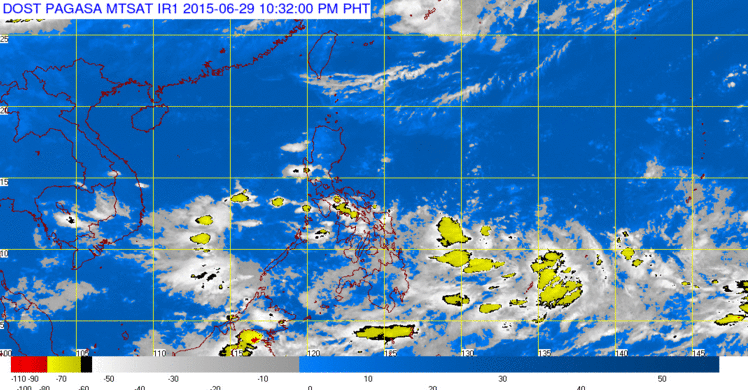
Low Pressure Area (LPA) was already spotted some 1,500 to 2,000 kilometers over the Pacific Ocean, stated by the PAGASA. According to weather forecaster Gladys Saludes in an interview with inquirer said that the LPA had a big chance of intensifying into a tropical depression and could possibly enter PAR on next week.
Be prepared next week for the incoming tropical depression and be more updated by visiting our site Attracttour.com or in the site of PAGASA.
One LPA was spotted at the Pacific Ocean while another LPA which may also develop into storm that was spotted some 500 kilometers east of the country.
There was an Inter-tropical Convergence Zone will bring cloudy skies with moderate to occasionally heavy rain and thunderstorms on Monday, July 6, 2015. Heavy rains may trigger flashfloods and landslides.
In the Visayas, light to moderate rains will prevail while in Metro Manila and the rest of Luzon, partly cloudy to cloudy skies with isolated rains will prevail.
For more updates, please follow us on Twitter and by linking us on Facebook.


