PAG-ASA update as of April 2, 2015) Bagyong Chedeng (Maysak) weakens as it enter PAR (Philippine Area OfResponsibility) as it takes the path of west northwest this Thursday.
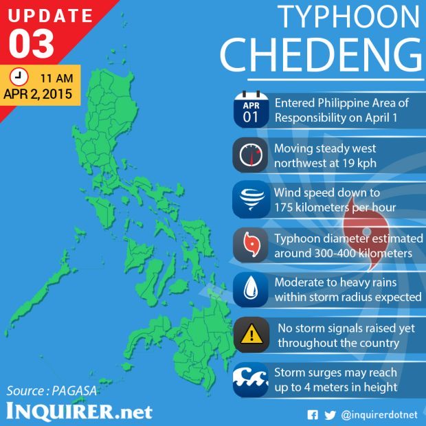
The latest strength of the typhoon is it has winds of 175 kilometers per hour near the eye of the strom and gust of 210 kph, even though is it weaken it does not that is it not destructive.
According to Esperanza Cayanan PAG-ASA officer in charge the typhoon will hit Aurora or Isabela this Saturday and Sunday and raised storm signal no.1 at Bicol Region and Northern Samar, local fishermens and and small vessels are strictly advised not to go seas because of thisweather disturbance.
Sea travel over these areas will be suspended, she added.
The public is also warned for a storm surge which has a height of almost 4 meters especially the Baler Bay with is the most prone area where the surge is expected to happen.
PAG-ASA added that the public must take heed for flash floods for those who are living on low area and landslide warning for those who are the residents of mountanious place especially Isabela and Aurora province.
They also added that before the strom the public must have this useful apparatus like transistor radios, flashlights, medicine and first aid kits and importantly extra money for fast mobilization to acquire emergency things as soon as possible.


