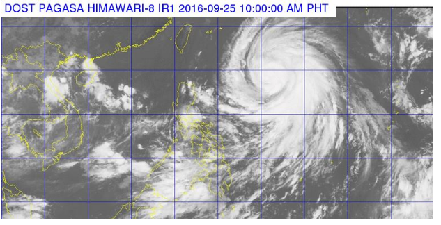
Typhoon ‘Helen” the eight typhoons that have entered this year the Philippine Area of Responsibility (PAR) has been slightly intensified as it moves forward in the direction of Batanes-Taiwan area, The Philippine Atmospheric, Geophysical and Astronomical Services Administration (PAGASA) weather bureau announce on Sunday, September 25, 2016.
‘Bagyong Helen with an international name Megi is located at 1,025 km East of Calayan, Cagayan, 19.6°N, 131.2°E at 10:00 am. The typhoon has a maximum sustained winds up to 140 kph near the center and gustiness of 175 kph forecasted to move West Northwest at 22 kph.
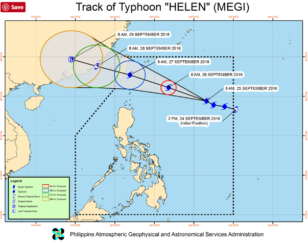
The PAGASA raised tropical cyclone warning signal No. 1 at 30-60 kph expected in 36 hours in Batanes and Babuyan Group of Islands.
The typhoon has an estimated rainfall amount is from moderate to heavy within 800 km diameter. The weather bureau added that the sea travel is risky near the northern and eastern seaboards of Northern Luzon.
‘Helen’ is expected to be out of the country on Wednesday morning, September 28 and considered as the third typhoon to affect Northern Luzon in two weeks as it earlier hit by Typhoons “Ferdie (Meranti) and “Gener (Malakas).