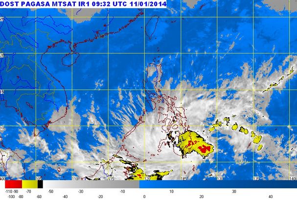
Agaton’s latest update as of January 11, 2014 at 5:00 a.m. the Low Pressure Area (LPA) is continue affecting the southeast of General Santos City at around 4:00 p.m. with the record coordinates at (4.80N, 127.00E) according to the weather bulletin of PAGASA.
The strong wind is continuing to affect the following areas: the northern and eastern seaboards of Luzon and the seaboards of Visayas, Caraga Region, Misamis Provinces, Zamboanga del Norte, Davao Oriental and Davao del Sur.
According to PAGASA the Low Pressure Area affecting the country today if it is fully develop into a tropical cyclone it will be named “AGATON” but PAGASA also said that the Low Pressure Area (Northeast Monsoon) failed to become a tropical cyclone.
Read here on the table below the latest weather update from PAGASA as of 5:00 p.m January 11, 2014.
Related Article: Super Typhoon Yolanda 2 “Agaton” is Hoaxed.
Related Article: Agaton Enters the Philippine Area of Responsibility January 10, 2014
Fishing boats and other small seacrafts are advised not to venture out into the sea while larger sea vessels are alerted against big waves. The next update will be issued at 5:00 a.m. tomorrow. |
Source: http://www.pagasa.dost.gov.ph/wb/glfcst.html


