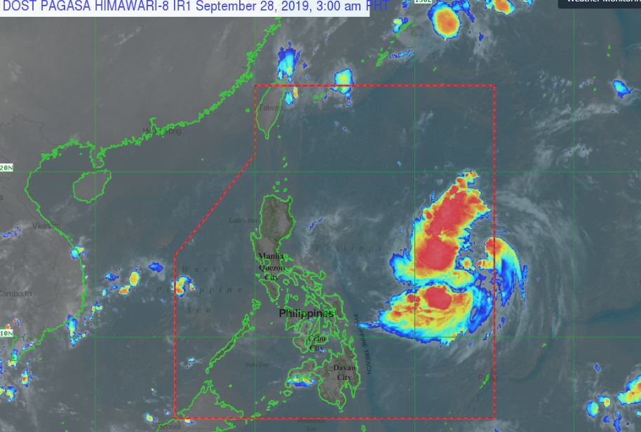
The Philippine Atmospheric, Geophysical and Astronomical Services Administration (PAGASA) stated that the Tropical Depression outside the Philippine Area of Responsibility (PAR) has entered the PAR and was named “ONYOK.”
Earlier, PAGASA stated that a low-pressure area spotted east of Visayas has intensified into a tropical depression on Friday and may turn into a storm in 24 hours.
PAGASA Forecast Positions and Intensities: (1,155 km East Northeast of Borongan City, Eastern Samar (16.2°N, 135.0°E)
PAGASA UPDATES:
As of 4:00 AM today, the center of Tropical Depression “ONYOK” was estimated based on all available data at 1,100 km East of Virac, Catanduanes (15.2 °N, 134.3 °E ).
Moving Northwest at 30 kph and has a Maximum sustained winds of 55 kph near the center and gustiness of up to 70 kph.
According to PAGASA, ” Today until tomorrow. the trough of Tropical Depression “ONYOK” will bring scattered light to moderate rainshowers and thunderstorms over Bicol Region and Eastern Visayas. Residents of these areas, especially those living in areas identified to be highly or very highly susceptible to floods and rain-induced landslides, are advised to take precautionary measures, coordinate with local disaster risk reduction and management offices, and continue monitoring for updates, especially the Thunderstorm or Rainfall Advisories and Heavy Rainfall Warnings to be issued by PAGASA Regional Services Divisions. “
- TD “ONYOK” may intensify into a Tropical Storm within 24 hrs.
- “ONYOK” is less likely to make landfall in the country throughout the forecast period.
Share your thoughts and comment in discussion box below.


