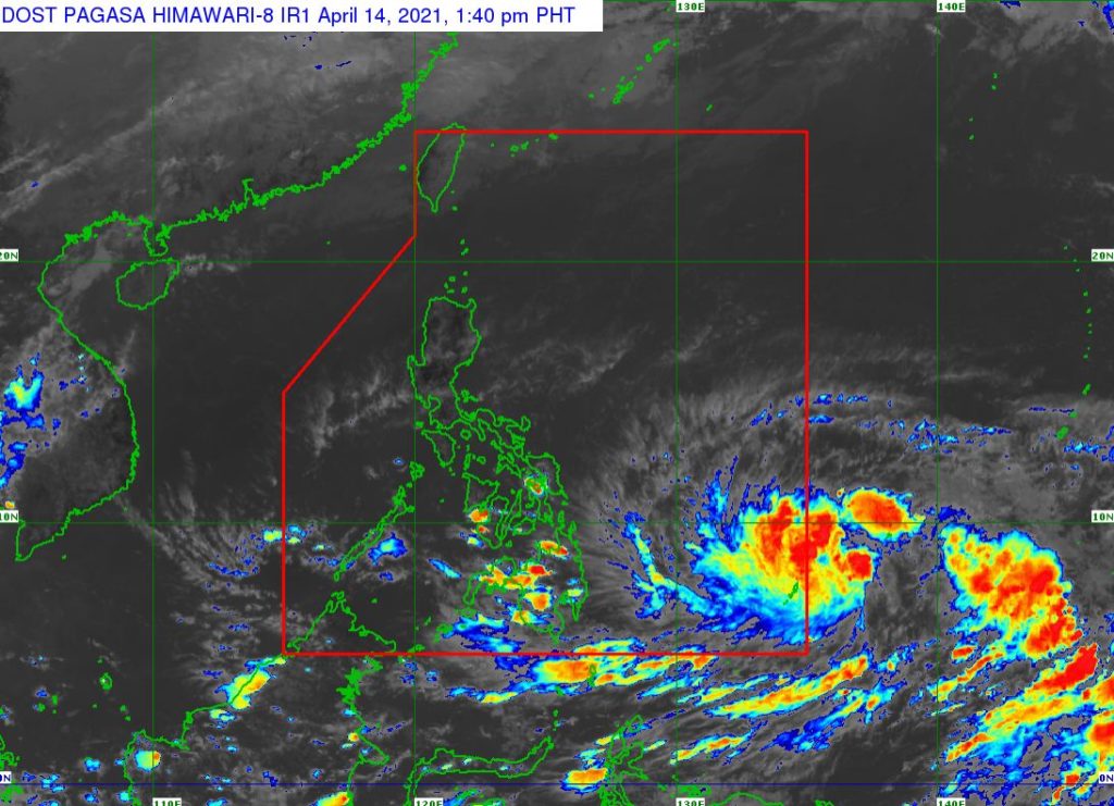
Tropical Storm “SURIGAE” slightly intensifies while almost stationary. The location of the center of Tropical Storm “SURIGAE” was estimated based on all available data at 1, 205 km East of Mindanao (Outside PAR) (08.2°N,137.3°E).
The NDRRMC, through Memorandum 34 s. 2021, directed the Chairpersons of the Regional Disaster Risk Reduction and Management Councils (RDRRMCs), OCD Regional Directors and Local DRRM Councils to conduct risk communication activities, disseminate warnings and advisories to communities at risk; initiate Pre-Disaster Risk Assessment (PDRA) meetings; activate their respective Emergency Operations Center (EOCs); conduct inventory of resources for response; and preposition their assets and rescue teams.
The tropical storm was spotted 1,210 kilometers east of Mindanao outside the Philippine Area of Responsibility as of 3:00 AM today, April 14, 2021, and is moving north-northwest at speed of 10km per hour. It may enter the country on Friday as a typhoon and will be named “BISING.”
The tropical storm remains less likely to directly affect the country, the Philippine Atmospheric, Geophysical and Astronomical Services Administration (PAGASA) said in its latest public weather forecast today. It is forecast to intensify but it is unlikely to make landfall, the state weather bureau added.
Share your thoughts and comment in the discussion box below.


