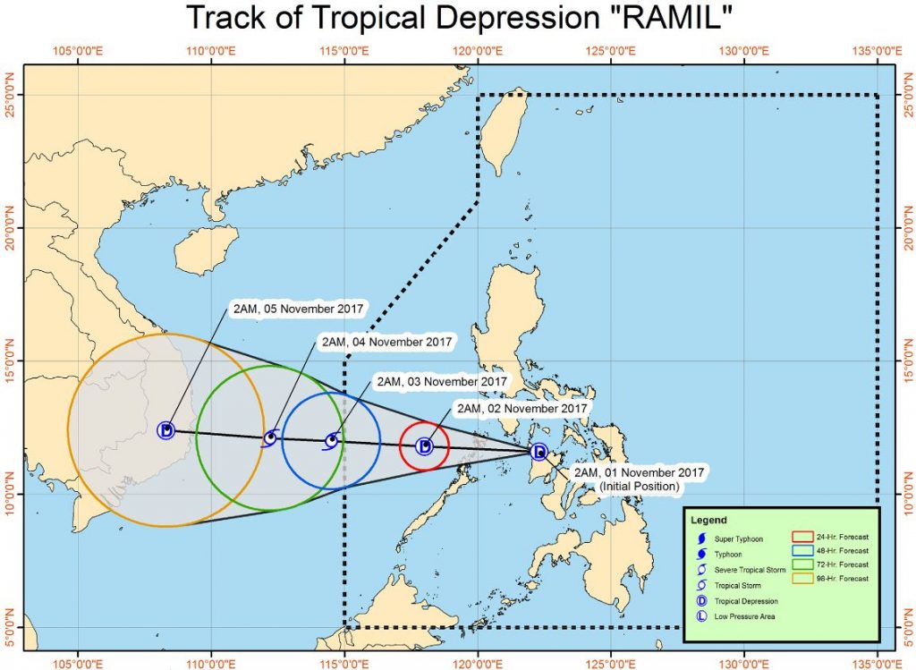
PAGASA release latest updates of Bagyong Ramil in November 1, 2017, at around 5 am. According to PAGASA, “the low pressure area south southwest of Masbate City, Masbate has developed into a tropical depression and was named “Ramil.”
Ramil is expected to land fall in the Calamian Group of Island today. Signal no. 1 including Metro Manila, Bicol region, CALABARZON, rest of MIMAROPA are advised to be alerted against possible flashfloods and landslides.
PAGASA warning to the sea travel because it is risky over the seaboards of Northern Luzon and the eastern seaboard of Central and Southern Luzon.
During 4:00 am forecast, the center of Tropical Depression “RAMIL” was estimated based on all available data at 115 km West of Roxas City, Capiz (11.7 °N, 121.7 °E).
Maximum sustained winds of 45 kph near the center and gustiness of up to 70 kph, said PAGASA.
PAGASA latest forecast:
Forecast Movement: Forecast to move West at 20 kph
Forecast Positions:
24 Hour(Tomorrow morning): 245 km West of Coron, Palawan(11.8°N, 118.0°E)
48 Hour(Friday morning):120 km North Northeast of Pagasa Island, Palawan(12.0°N, 114.5°E)
72 Hour(Saturday morning): 245 km West Northwest of Pagasa Island, Palawan(12.1°N, 112.2°E)
96 Hour(Sunday morning):655 km West Northwest of Pagasa Island, Palawan(12.4°N, 108.3°E)
Share your thoughts and comment in discussion box below!


