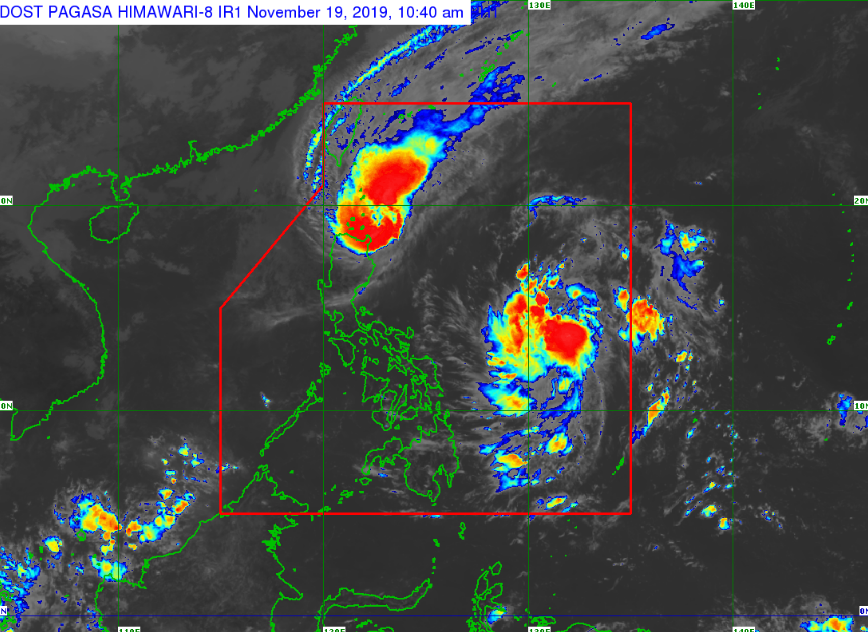
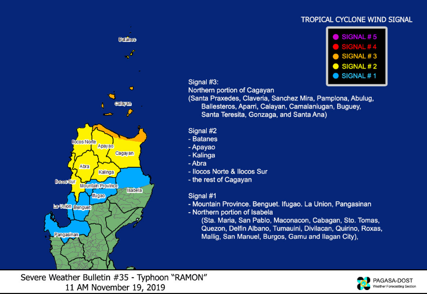
The Philippine Atmospheric, Geophysical and Astronomical Services Administration (PAGASA) releases updates of Typhoon “Ramon” on Tuesday, November 19, 2019. Typhoon “Ramon” remained almost stationary and continues to increase the threat over Babuyan Islands.
According to PAGASA, as of 10:00 AM today, the Low-Pressure Area (LPA) was estimated at 720 km East of Guiuan, Eastern Samar (11.7°N, 132.3°E). This weather disturbance is forecast to develop into a Tropical Depression within 24 hours.

The eye of Typhoon “RAMON” was located based on all available data at 120 km East of Calayan, Cagayan(19.1°N, 122.6°E).
The strength of Tropical Depression “Ramon,” has a sustained winds of up to 120 km/h near the center and gustiness of up to 165 km/h.
According to PAGASA reports:
• Rainfall outlook for today (Tuesday): Moderate with frequent heavy rains over Batanes, the northern portion of Cagayan including the Babuyan Islands, Apayao and the northern portion of Ilocos Norte. Light to moderate with intermittent heavy rains over the northern portion of Isabela, Kalinga, Abra and the rest of Cagayan and Ilocos Sur.
• Rainfall outlook for tomorrow (Wednesday): Light to moderate with occasional heavy rains over Batanes, northern and eastern portions of Cagayan including the Babuyan Islands, eastern portion of Isabela, Apayao and Kalinga. Light to moderate with intermittent heavy rains over the northern portion of Aurora and the rest of Cagayan and Isabela.

Share your thoughts and comment in discussion box below.


