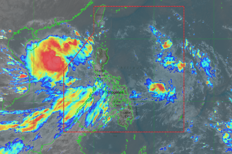
As of 10:00 AM today, the center of Tropical Storm “JENNY” was estimated based on all available data at 305 km West Northwest of Dagupan City, Pangasinan or 290 km West of Sinait, Ilocos Sur (17.1 °N, 117.7 °E ). ‘Bagyong Jenny’ has maximum sustained winds of 65 kph near the center and gustiness of up to 80 kph.

“JENNY” is expected to exit the Philippine Area of Responsibility today between 11:00 AM and 2:00 PM.
According to PAGASA:
- All Tropical Cyclone Wind Signals have been lifted. However, occasional gusts may occur in Visayas and in other areas of Luzon due to the Southwest Monsoon.
- Today, light to moderate with intermittent heavy rains will be experienced over Western Visayas, Zamboanga Peninsula, Mindoro Provinces, Romblon, and Palawan (including Calamian and Cuyo Islands) due to the Southwest Monsoon. Meanwhile, scattered rains may prevail over Bangsamoro, Ilocos Region, Zambales, and Bataan.
- Residents of these areas, especially those living in areas identified to be highly or very highly susceptible to floods and rain-induced landslides, are advised to take precautionary measures, coordinate with local disaster risk reduction and management offices, and continue monitoring for updates, especially the Thunderstorm or Rainfall Advisories and Heavy Rainfall Warnings to be issued by PAGASA Regional Services Divisions.
- Sea travel remains risky over the seaboards of Luzon and the western seaboard of Visayas due to potentially rough sea conditions.
Share your thoughts and comment in discussion box below.


