Typhoon Chedeng (International name Maysak) is no longer a super typhoon after entering the Philippine Area of Responsibility (PAR) around 11 p.m. last Wednesday, April 1, 2015, according to PAGASA.
Bagyong Chedeng is now weakening and was downgraded upon entering the country but it is armed with a massive diameter of 200 km radius and destructive force powerful enough to spoil the country’s observance during the Holy Week.
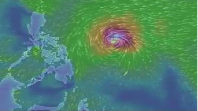
According to PAGASA, the tropical storm Chedeng is expected to weaken even further for the duration of its stay in the country. Last April 2, 2015, as of 10 a.m. PAGASA stated that the storm Chedeng sits 995 kilometers east of Catarman, Nothern Samar, or 915 km east northeast of Borongan, Eastern Samar, and packs maximum sustained winds of 175 kilometers per hour (kph) near the center and gusts of up to 210 kph.
Latest updates:
- (4 p.m.) Chedeng was located 970 km east of southeast Virac, Catanduanes with maximum sustained winds of 175 kph and gustiness of up to 210 kph. It is forecast to move northwest at 15 kph.
- Metro Manila will have partly cloudy to cloudy skies with isolated rainshowers or thunderstorms for the next 24 hours.
- (3 p.m.) Chedeng sits 930km east of Catarman, Northern Samar or 975 km east southeast of Virac, Catanduanes, according to PAGASA radar.
- PAGASA says that the typhoon has slightly weakened as it continues to move in a northwest direction.
- The agency estimates it to make landfall over eastern coast of Aurora or Isabela by late Saturday (April 4) to early Sunday (April 5).
- It adds that storm surges and sea surface waves of up to 4 meters are possible over the eastern coast of Samar, Bicol and Aurora-Quezon.